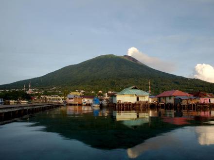
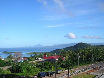
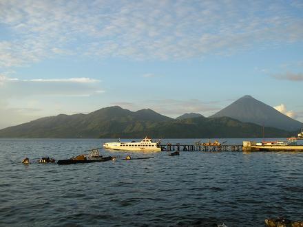
Bisnis di Jailolo
Hotel & Wisata
Restoran
Otomotif
Layanan Keuangan
Medis
Kecantikan & Spa
Komunitas & Pemerintah
Industri
Distribusi Bisnis berdasarkan Industri Belanja: 17,7%
Agama: 16%
Restoran: 10%
Hotel & Wisata: 9,8%
Pendidikan: 8,6%
Makanan: 6,1%
Industri: 5,3%
Layanan Profesional: 5,3%
Lainnya: 21,2%
| Area Jailolo, Maluku Utara | 25,1 km² |
| Kode Area | 9 |
| Waktu Setempat | Jumat 11.06 |
| Zona Waktu | Waktu Indonesia Timur |
| Grs Lintang & Grs Bujur | 1.06504° / 127.46786° |
| Kode Pos | 97752 |
Jailolo, Maluku Utara - Peta
Indeks Pembangunan Manusia (IPM)
Indeks komposit statistik dari harapan hidup, pendidikan, dan pendapatan per kapita.Sources: [Link] Kummu, M., Taka, M. & Guillaume, J. Gridded global datasets for Gross Domestic Product and Human Development Index over 1990–2015. Sci Data 5, 180004 (2018) doi:10.1038/sdata.2018.4
Risiko Bencana Alam
Risiko relatif dari 10| Tanah longsor | (8) Tinggi |
| Kekeringan | (7,7) Tinggi |
| Gunung berapi | (6) Sedang |
| Gempa bumi | (6) Sedang |
* Risiko, terutama yang menyangkut banjir atau tanah longsor, mungkin tidak untuk seluruh area.
Sources: 1. Dilley, M., R.S. Chen, U. Deichmann, A.L. Lerner-Lam, M. Arnold, J. Agwe, P. Buys, O. Kjekstad, B. Lyon, and G. Yetman. 2005. Natural Disaster Hotspots: A Global Risk Analysis. Washington, D.C.: World Bank. https://doi.org/10.1596/0-8213-5930-4.
2. Center for Hazards and Risk Research - CHRR - Columbia University, Center for International Earth Science Information Network - CIESIN - Columbia University. 2005. Global Earthquake Hazard Distribution - Peak Ground Acceleration. Palisades, NY: NASA Socioeconomic Data and Applications Center (SEDAC). https://doi.org/10.7927/H4BZ63ZS.
3. Center for Hazards and Risk Research - CHRR - Columbia University, Center for International Earth Science Information Network - CIESIN - Columbia University, and Norwegian Geotechnical Institute - NGI. 2005. Global Landslide Hazard Distribution. Palisades, NY: NASA Socioeconomic Data and Applications Center (SEDAC). https://doi.org/10.7927/H4P848VZ.
4. Center for Hazards and Risk Research - CHRR - Columbia University, Center for International Earth Science Information Network - CIESIN - Columbia University, and International Research Institute for Climate and Society - IRI - Columbia University. 2005. Global Drought Hazard Frequency and Distribution. Palisades, NY: NASA Socioeconomic Data and Applications Center (SEDAC). https://doi.org/10.7927/H4VX0DFT.
5. Center for Hazards and Risk Research - CHRR - Columbia University, Center for International Earth Science Information Network - CIESIN - Columbia University. 2005. Global Volcano Hazard Frequency and Distribution. Palisades, NY: NASA Socioeconomic Data and Applications Center (SEDAC). https://doi.org/10.7927/H4BR8Q45.
Gempa Bumi Terdekat Terdekat
Magnitude 3.0 dan lebih tinggi| Tanggal | Waktu | Besarnya | Jarak | Kedalaman | Lokasi | Link |
|---|---|---|---|---|---|---|
| 17/02/19 | 05.18 | 4,5 | 12,8 km | 159.500 m | 38km N of Ternate, Indonesia | usgs.gov |
| 28/09/17 | 22.25 | 4,5 | 4,5 km | 7.710 m | 32km NNE of Ternate, Indonesia | usgs.gov |
| 28/09/17 | 16.01 | 4,7 | 11,8 km | 6.020 m | 34km NNE of Ternate, Indonesia | usgs.gov |
| 27/09/17 | 15.37 | 4,1 | 8,7 km | 10.000 m | 29km NNE of Ternate, Indonesia | usgs.gov |
| 29/03/16 | 10.16 | 4,3 | 8,7 km | 10.000 m | 30km N of Ternate, Indonesia | usgs.gov |
| 23/02/16 | 13.01 | 4,5 | 4,9 km | 9.940 m | 25km NNE of Ternate, Indonesia | usgs.gov |
| 23/02/16 | 12.47 | 5,4 | 4,4 km | 13.700 m | 29km N of Ternate, Indonesia | usgs.gov |
| 19/01/16 | 15.38 | 4,6 | 10,5 km | 11.770 m | 19km NNE of Ternate, Indonesia | usgs.gov |
| 13/12/15 | 15.03 | 4,4 | 14,7 km | 13.780 m | 15km NNE of Ternate, Indonesia | usgs.gov |
| 08/12/15 | 10.35 | 5 | 9,8 km | 10.040 m | 24km NNE of Ternate, Indonesia | usgs.gov |
Temukan gempa bersejarah yang terjadi di dekat Jailolo, Maluku Utara
Tanggal Terlambat Kencan terakhir
Magnitude 3.0 dan lebih tinggi Besarnya 4.0 dan lebih besar Besarnya 5,0 dan lebih besar
Tentang Data Kami
Data pada halaman ini diperkirakan menggunakan sejumlah alat dan sumber daya yang tersedia untuk umum. Ini diberikan tanpa jaminan, dan dapat mengandung ketidakakuratan. Gunakan dengan risiko Anda sendiri. Lihat di sini untuk informasi lebih lanjut.